Now my son is two, he’s rather heavy for lugging about in backpack carrier. Easier to take the pushcair, for carrying him when tired – or when dawdling too much. This, though, means trying to avoid flights of steps. Just took him for outing in southern Cheung Chau, following good route along trails that are mostly concrete, with maybe only a handful of steps in all. Maybe useful if you, too, have toddler with pushchair – or just dislike steps!
This route starts with walk to southwest Cheung Chau, then heads east, along the “spine” if the southern chunk of the island, to the southeast, and the main beach. Takes maybe two to three hours.

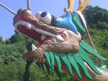
Walk south from the ferry pier, and follow the waterfront. The narrow road – which is popular with weekend and holiday strollers and cycliests – soon leaves the main village, and passes a dragon boat. Then comes the village of Sai Wan, which has a tiny harbour, as well as a few small stores where you could buy drinks.
At Sai Wan, keep to the main road as it climbs a little and turns left. After leaving the village, look for a junction where a path turns right – for a very worthwhile detour.

The path leads down to a cove with a small beach – known to expats living here as the Italian Beach.


This is a lovely place; ok for swimming tho need care with all the rocks – and there’s no lifeguard service. At times, can have this beach to yourself (I took these shots on Mid-Autumn Fesitival public holiday).

Onwards! Walk back up to the main path – which is Peak Road, though it’s really little more than a footpath. This leads up to pass a cemetery; there’s a good view across southeast Cheung Chau to Lantau (providing there isn’t too much smog, that is!).

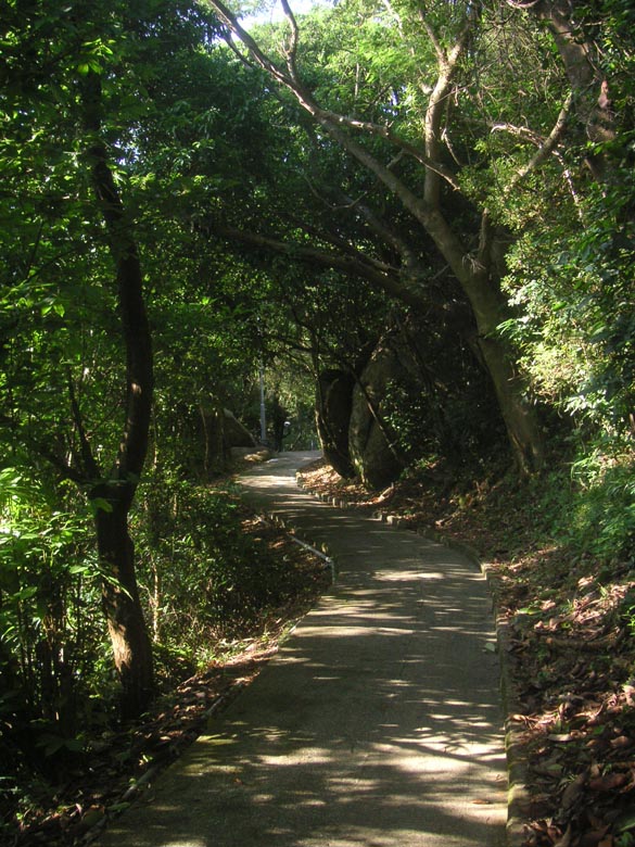
The trail becomes almost level, and is shaded by trees that have grown tall since I came to the island (photos from the 1940s show a very barren looking island: much different to Cheung Chau today).

Here’s another shady stretch of trail, passing close to the Cheung Chau weather station, at the highest point on the island. No one in sight here: even when the village and beach are busy, trails like this can be quiet.

The trail passes a relatively new housing estate. At this junction, you could turn left to wind down a small road – a stepless route back down to the waterfront.
Continue along Peak Road, and you’ll pass this tall, slim school.

Peak Road passes houses – mostly three storey. But there are still trees, and occasional views over the sea and across Cheung Chau.
On past houses and a Bible seminary, there’s this junction. Straight on, Peak Road leads towards the ferry pier. But turn right, and you can tour southeast Cheung Chau.


After passing a sports ground, then turning right towards the coast, you arrive at a trail that winds above rocky shorelines; pass Seascape Peninsula, and ignore a left turn, and you’ll be on this stretch of trail, with views of boulder strewn slopes on a small headland.
There’s another junction, where this sign shows the way for the Pushchair Explorer’s Route.

Providing it’s a fine day, you can soon enjoy a grand view across Cheung Chau, to Lantau beyond.

Then, there’s more shady trail, past an Indian rubber tree with aerial roots thickened into new trunks in a bid to form a one-tree forest.

Are we there yet?
Alnost, almost. Down the side of Fa Peng valley, and then…

And then you arrive at Kwun Yam Wan, with its pleasant beach. A good place for adults and toddlers alike. Plus, you can get some liquid refreshments at beach bar here, or at nearby Windsurfing Centre.


A great Cheung Chau aft without being ambitious
I received the following email re the above:
My twins who are 3 have just got likeabikes (the bicycles without peddles) and are having the greatest time on them going up to 7kms on country park paths! The bikes don’t have breaks though and any rolonged steeply downhill stretch is therefore impossible for them.
Long uphill stretches are also v. tiring for them. I was wondering hether you might be able to give me any information on the length of he uphill and downhill, how much of the walk is significantly uphill r downhill and how steep the hill parts are?
It would be so kind of you to give me any information as there are ery few places to have fun on the bikes.
I replied:
There are fair uphill (and, so, downhill) stretches along s Cheung Chau.
But, you – n the twins – can readily go up n down the waterfront, left n right from the ferry pier, inc to outside the village area; gives chance to visit beaches – nicest being the one in southwest, near Sai Wan: for latter, will be some walking w bikes, as up n down; or maybe can leave in Sai Wan if you’ve locks – perhaps by one of small stores.
Can also head across to west coast, for riding alongside beaches there.
Parts can be a little busy w weekend cyclists, but not too bad I think; I fairly often take out my 2 1/2 yr old along these small roads/paths,
inc on tricycle I push him on.
led to:
We plan to go back again and explore a bit further afield with your helpful guidelines in hand!!